Day Two of Wandering

Today was a big driving day because the weather was wet and windy and did not lend itself to walking outside a lot. I have realized that when one is traveling with a dog it limits what you can do indoors. I cannot sit in a restaurant (so takeout is the go-to) and when the weather is lousy I can’t lounge in a bookstore for hours on end.

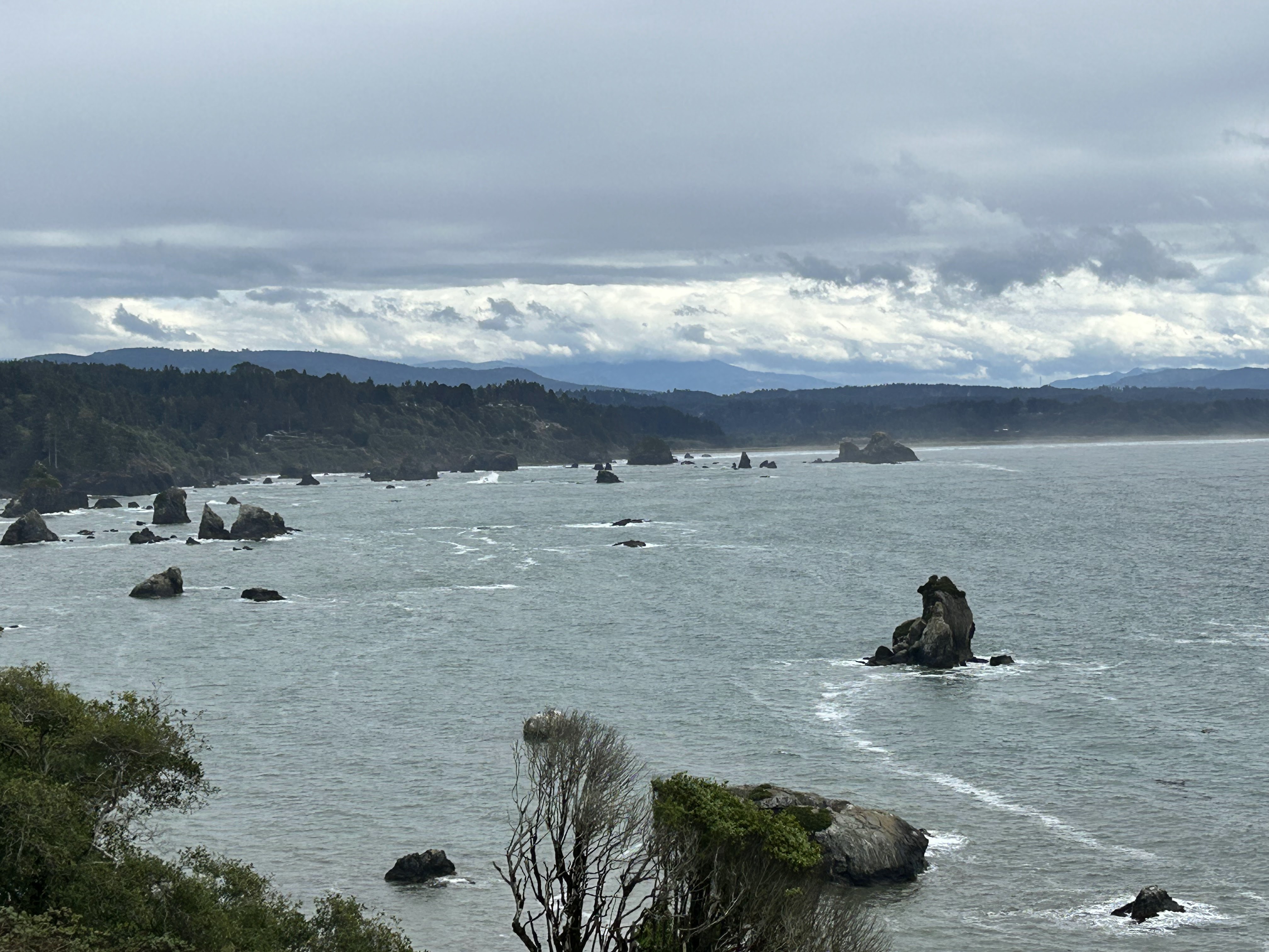
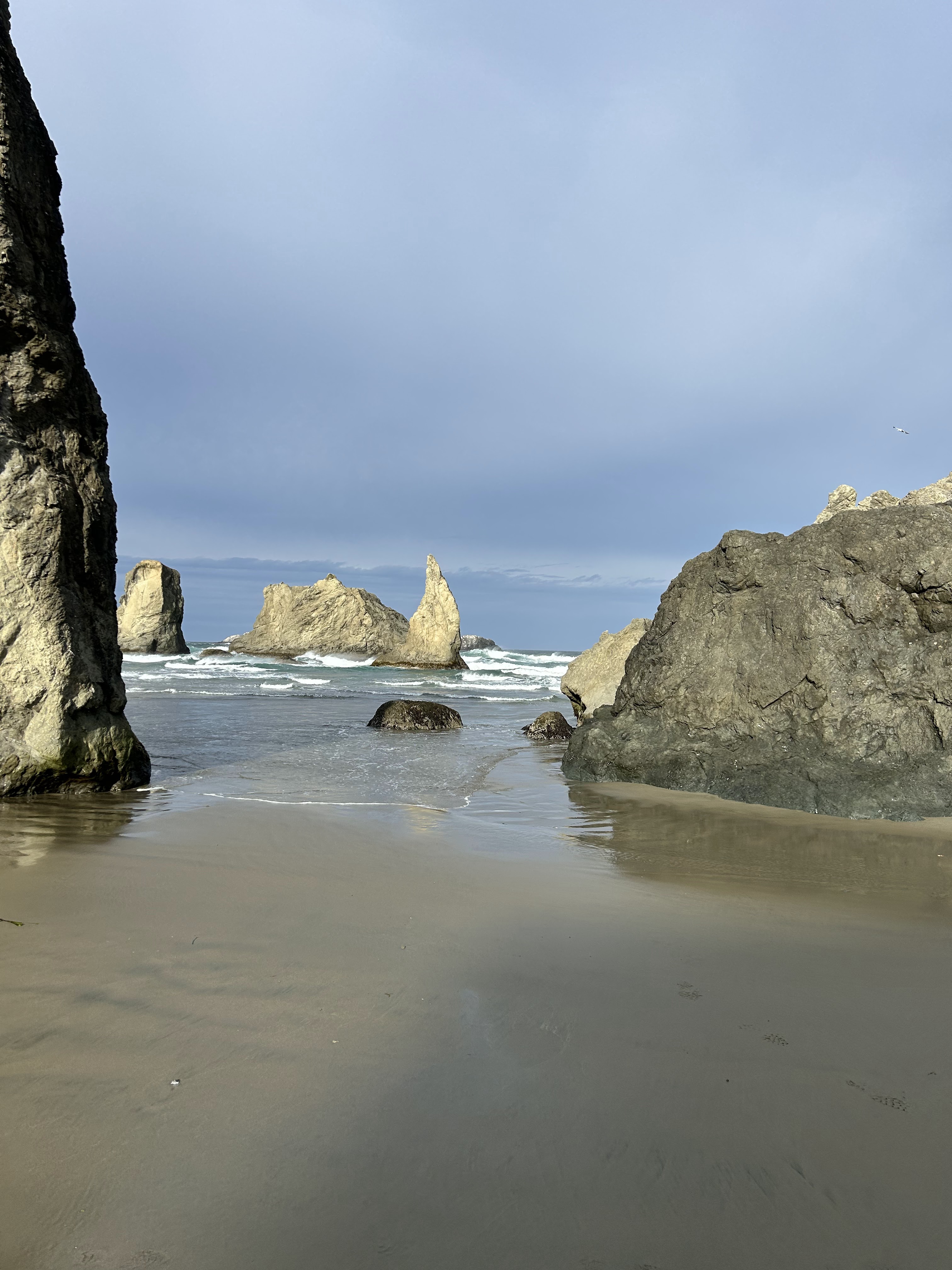
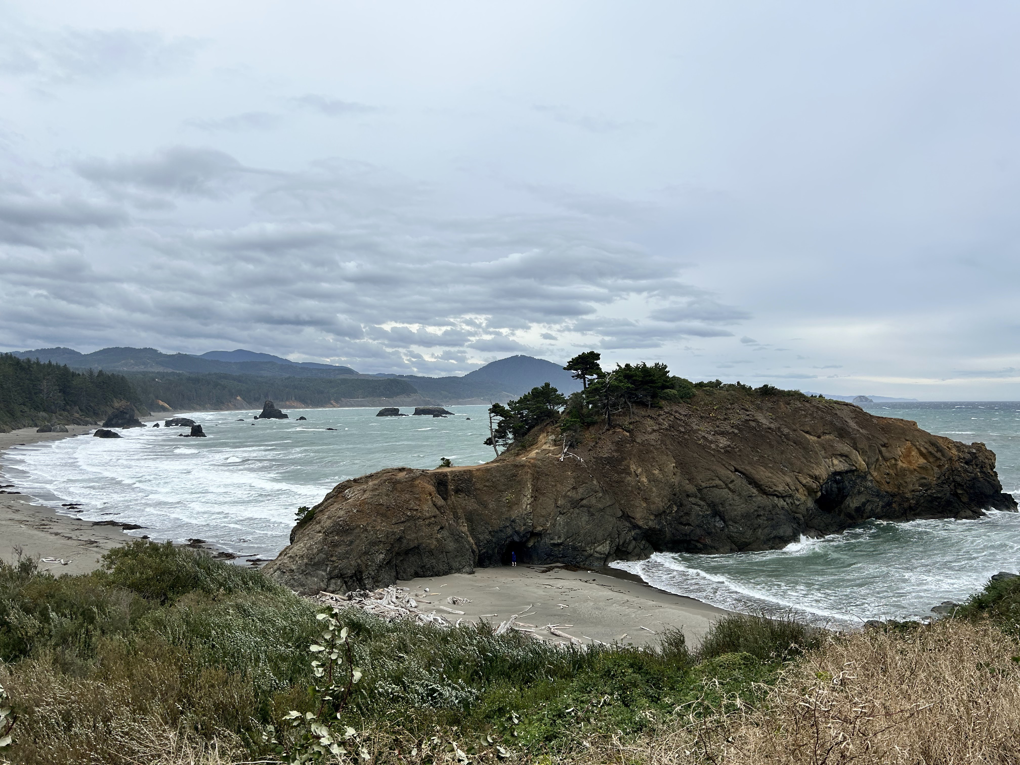
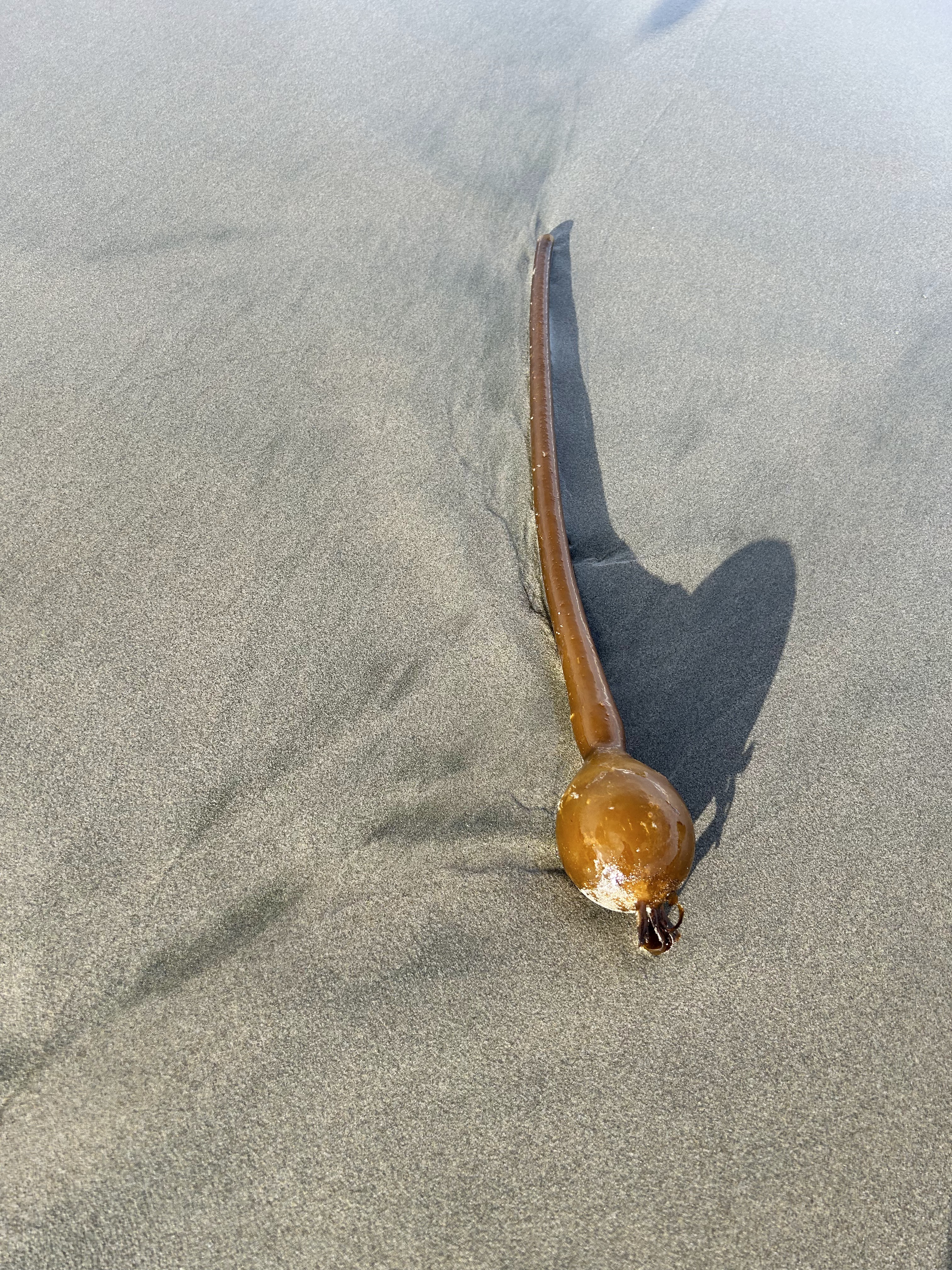
Nonetheless we saw a lot. We left the hotel by 8 a.m. because the rain was scheduled to start at 11 a.m. This plan proved to be wise because Bandon Beach was BEAUTIFUL this morning and the sun was shining. We started at Cocquille Point, walked down the stairs and to the beach. Jutting rocks were everywhere. Pete was unimpressed by the giant puffin statue made from debris. Pete immediately rolled in the sand…over and over again. He truly loves the beach. We walked the length of the beach and then returned to the car to continue down the 101.

Port Orford was next. It was a quaint town focused on art. We stopped at the Battle Rocks Wayside Park for the stunning views and then moved on to Gold Beach. Gold Beach is where the Rogue River and the ocean meet. We stopped quickly at a viewpoint but then moved on as the weather was very wet.

On the way to Brookings we stopped along the Samuel Boardman State Scenic Corridor and decided it was time for fish and chips. Happy Clam did not disappoint.

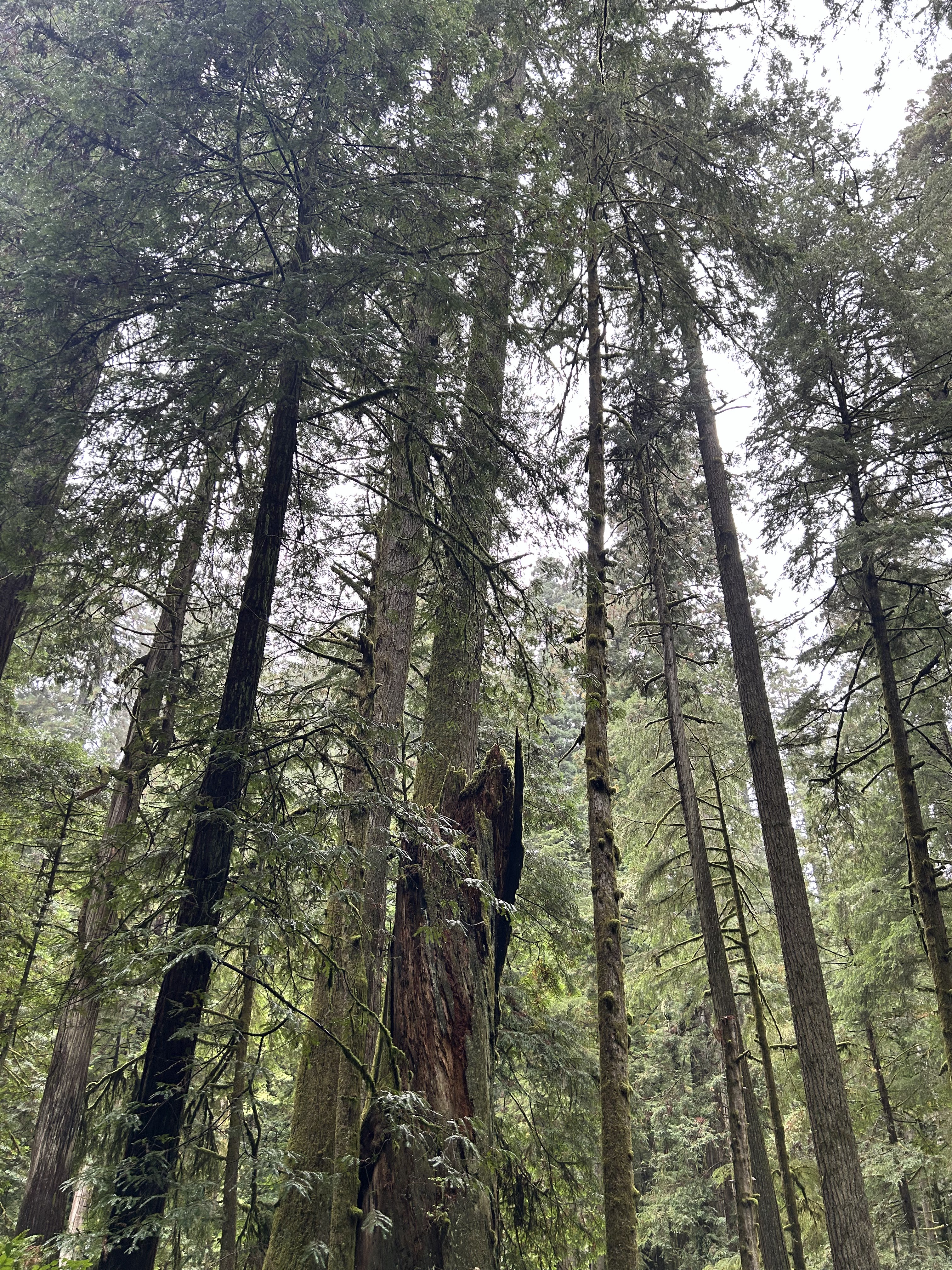
Jedediah Smith Redwoods State Park was next on the route. We stopped at the ranger station to get a map and will do the Avenue of the Giants tomorrow. The trail I really wanted to walk was just too wet and muddy and I really wasn’t prepared. The stunning drive through the park was dark as the trees were amazingly tall.

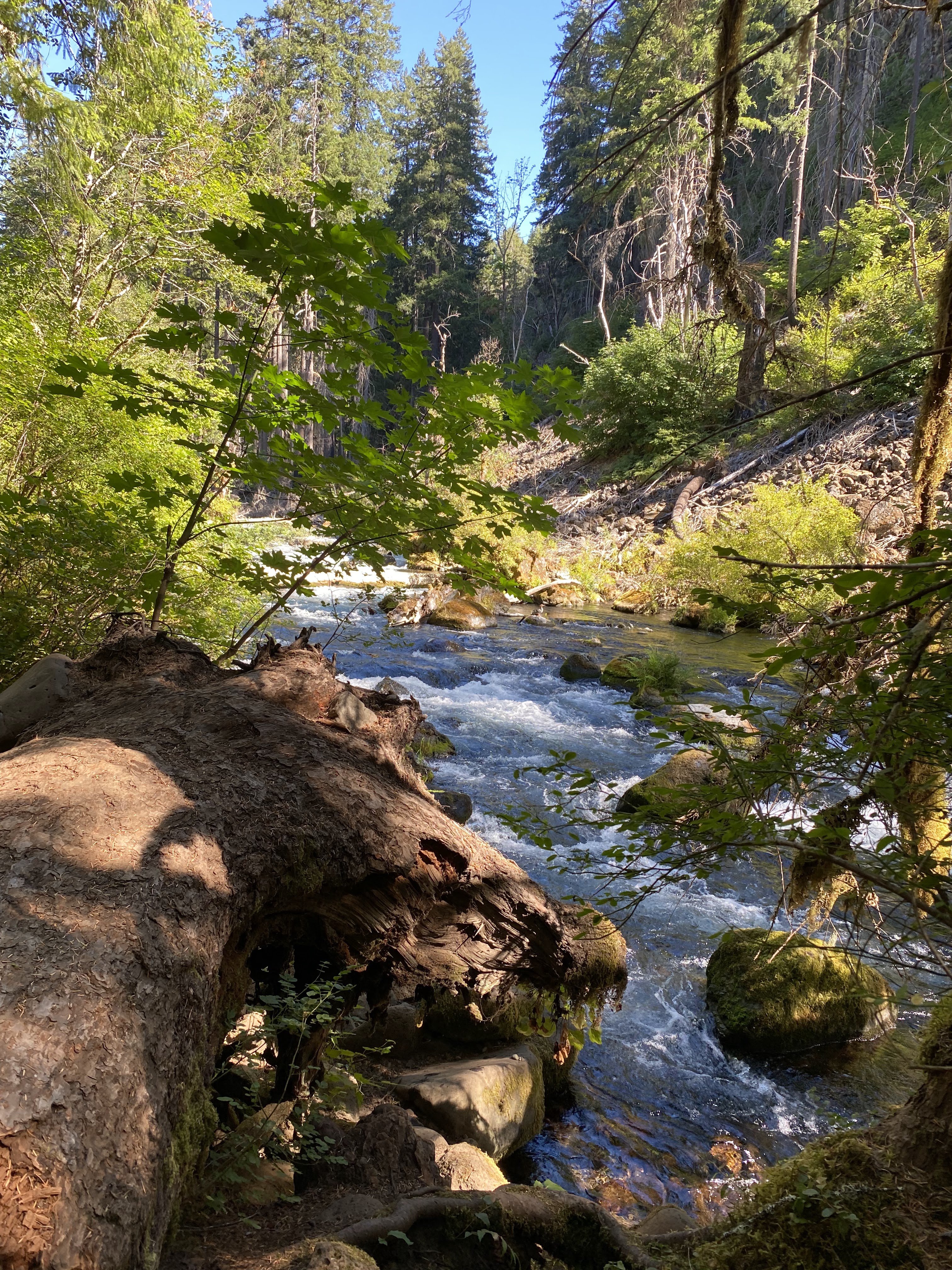
Next up was Trinidad, which is a small town of about 300 people. It had a beautiful bay overlook but no access to a beach we could walk. By now my butt was hurting and Pete was tired of being a passenger so we found a hotel in Arcata and called it a night! Overall the drive along the 101 is mesmerizing with its stunning views, rock formations and crashing waves.

Travel Apps

There is no doubt that travel apps make travel easier, from planning to in-the-moment needs. I have some favorites and I tend to gravitate towards apps that are easy to use and relatively inexpensive. Loyalty programs apps are automatically part of my toolbox because it makes it easy to accumulate and use points within the app. The loyalty programs I have are Bonvoy (Marriot) and World of Hyatt (Hyatt). And of course airline apps are a no brainer. My go-to apps are Alaska and Delta.

For transportation I have Uber, Lyft and Grab (great in Asia). These apps are all pretty straightforward and simple to use. I also have the Clipper card app which makes paying for mass transit super simple. One app that is crazy useful is Rome2Rio. The directions to get from one location to the other with a mix of mass transit, taxi, driving, walking and even a town car just cannot be beat! It also outlines the time, cost and miles for each option.

Translation apps are key for effective communication and I like Translate and Google Translate. It doesn’t get easier to translate written or spoken words with either of these apps. I especially love the camera feature that allows the user to take a picture of text and the apps translates it. So easy!

I use Expedia and Booking for last minute hotels and Airbnb when I am planning ahead for lodging. I recently downloaded Hotel Tonight and am excited to try it out on my upcoming wandering journey. Since I will travel from Arizona to Georgia and will be in a different city/town each night and won’t really be able to predict where I will be specifically the app should be helpful…the joy of slow travel.

Currency is easily converted using the Xe app.

With my new AAA membership, I downloaded the app and look forward to to using the TripTik Planner. The app also has a section showing nearby gas stations with the cost per gallon. Hopefully I won’t need it, but I can easily request roadside assistance through the app, too.

CBP MPC is a free mobile passport control app. It allows users to submit their passport info and answer custom declaration questions electronically which will get you through customs faster.

AllTrails is my preferred app to use when hiking and I am sure as I stop to see different things along my journey, I will use this app to catch a hike or two along my way.

And finally my Libby app allows me to borrow and download audiobooks from the library. I will use this as I drive miles and miles along the highways on my upcoming trip.

What apps do you use for travel?

Mt. Rainer

Mt. Rainer has been on my must-do-list for a long time. As my time in Oregon and the Pacific Northwest winds down, I am a bit more urgent about achieving some of those must-visit goals. Mt. Rainer did not disappoint. Fairly last minute, I was able to get a hotel room at the Whittaker Hotel & Bunkhouse. The nightly rate was “reasonable” given high season, the rooms were rustic and the staff friendly. I also liked that the hotel was an homage to Lou Whittaker, who died in Ashford at the age of 96 and summited Mt. Rainer at the age of 12!

I left Portland at 6 a.m. and went right to the park, with no timed entry at the Nisqually pass. I started at the visitor center and did the Skyline Loop (5.5 miles).  This loop trail is the quintessential Paradise area trail. It starts at the main visitor area up through subalpine meadows. Along the way I viewed Mount Rainier, glaciers, Panorama Point, Myrtle Falls and the Tatoosh Range, with glimpses of Mount Adams and Mount St. Helens. It was full sun exposure with 1700+ elevation gain AND beautiful!

On day two, I hiked Tipsoo Lake and the Naches Trail to Dewey Lake (about 5 miles) in the morning. Wildflowers and four different lakes rewarded me with the challenging uphill climb. And, of course, Mt. Rainer was present from all angles.

Reflection Lake to Narada Falls on the Lakes Trail Loop (about 6 miles). This large lake was another beauty with Mt. Rainier front and center (and its reflection on the lake) but the real reward were the multiple falls on the Lakes Trail Loop.

I met several people along the way that could not believe the natural beauty that I live in daily. I agree the world is a beautiful place and the lush, green forest coupled with larger than life mountains makes the Pacific Northwest a pretty special place.

Las Cruces Part Two

Day two consisted of Organ Mountains National Monument and Dripping Springs Trail. The hot temperatures forced me to slow down a bit. May was the 10th anniversary of this monument so entry was free. The spring was almost dry and the abandoned buildings suggested there was an outpost at one point. An early morning hike was the best way to counteract the heat with a rest in the middle of the day and then White Sands National Park in the evening for a sunset view.

I drove to Alamogordo for dinner since it is only 14 miles past White Sands National Park and sunset was the goal. I headed to the park at 6 p.m. Unfortunately the visitor center closed at 6 so I headed right into the park. It, too, was a free entry since it was after 6 p.m. It is mind blowing that the sand oasis exists in the middle of nowhere. It looks like snow but it really is sand! This park was the highlight of my trip.

North Cascades National Park

This past week I was finally able to check another item off my bucket list…North Cascades National Park. I’ve been intrigued by this destination after scrolling through lots of pictures from various sources and also learning that it is one of the least visited national parks. The lack of crowds was a definite draw. And needless to say, North Cascades National Park did not disappoint on either point.

The drive from Portland took about seven and a half hours and I drove through areas I have never seen before such as Yakima and Wenatchee. These areas seems to be an agricultural hub and were beautiful in their own right.

North Cascades National Park is known as the American Alps and I would say that name fits this stunning scenic area. The vistas, valleys and mountains were just incredible. I chose to stay in Winthrop, a small town holding on to it’s mining façade with enough shops and restaurants to provide options for a multi-day stay. Just driving on the North Cascades Highway (Hwy 20) is reward enough for the long drive to get to this amazing area.

Along Highway 20 are several overlooks and you should stop at EVERY SINGLE ONE. The Washington Pass Observation site is the first one heading west on Highway 20. It allows you to appreciate the magnitude of the mountains and the valley and if you are afraid of heights, get ready to be scared!

Next I hiked Rainy Lake, which is an very easy, but very rewarding hike. The path is easy, groomed and ends at a stunning alpine lake. Next stop was the Diablo Lake Vista Point and driving over the Diablo Dam. Equally stunning is the Gorge Lake Overlook and the suspension bridges to the Trail of the Cedars and Ladder Creek Falls.

The final jaunt of the day was hiking Blue Lake. This was a five mile hike with a little elevation. As we were climbing, hikers coming down spoke excitedly about the mountain goats at the lake. I have yet to see any animals during all my years of hiking so was thrilled to think I was finally going to see an animal in the wild! When we reached the incredibly blue and clear lake, there were no goats to be seen. I am guessing too many people had already seen the goats and they likely went to higher elevation to be left alone. Nonetheless the lake was incredible.

On the last mile of my descent, I tripped over a large rock and fell and hit my left knee very hard. That ended hiking for the day and the following day. The three hikes I had earmarked for the next day did not happen…sadly. Oh well, I guess it means I will need to return at some point. Regardless NCNP should not be missed.

Garibaldi Lake

I recently visited Vancouver, BC and hiked Garibaldi Lake. It was a 12 mile, 3211 elevation gain well-maintained trail. There was lots of switchbacks, inclines and three stunning lakes. The trail culminates in the magnificent Garibaldi Lake. This was a tiring, at times grueling hike, but well worth the effort!

Palm Springs in December is Perfect!

Cold nights and semi-warm days is Palm Springs in December. This trip was the fifth December trip to Palm Springs and I was able to get out and hike, which was great. Managed four hikes including the Coachella Valley Preserve, which although in the middle of nowhere, was fascinating. It sits on the San Andreas fault line and the water that seeps through the earth creates enough water for these palm trees to grow in the middle of the sandy desert.